
Services
Topographical Surveys
Detailed, survey grade terrain and feature data to underpin accurate design and confident development.
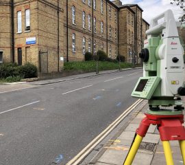
Topographical surveys record every feature on a site, including boundaries, buildings, service covers and ground levels. We use robotic total stations and GPS rover technology to deliver detailed 2D and 3D topographical surveys, from small residential plots through to multi million pound developments, all carried out to Royal Institution of Chartered Surveyors (RICS) standards. Deliverables are provided in AutoCAD DWG, PDF, DXF or Revit format, whichever suits your design team.
- Robotic total station and GPS rover survey technology
- 2D and 3D deliverables
- Carried out to RICS standards
- Suitable for sites of any scale
- DWG, DXF, PDF and Revit formats available